


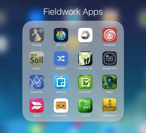
With preparations underway for fieldwork to support students with the new AS and A2 specifications and to provide them with tools that may be useful for their independent investigations I have been exploring options for useful apps to take into the field. The screenshot below is a small selection of some the key ones that we hope to use during fieldwork over the next couple of months. I will be reviewing some of these as and when we use them. For now just something to think about….
Page 1 – Fieldwork Apps
Page 2 – Fieldwork Apps
Filed under: Apps, Fieldwork, Geography | Tagged: Apps, Fieldwork, Geography |


Thanks aRob
Some of my favourites are:
TopoProfiler – do cross section profiles in the field on your phone – so many applications.
Altitude DC to show statistical data such as lat, long, alt on a photo… there are a few of these
Brilliant – thank you for those suggestions – I will definitely check those ones out!